scubabottler
Member
- Joined
- Sep 27, 2023
- Messages
- 14
- Reaction score
- 20
- Points
- 3
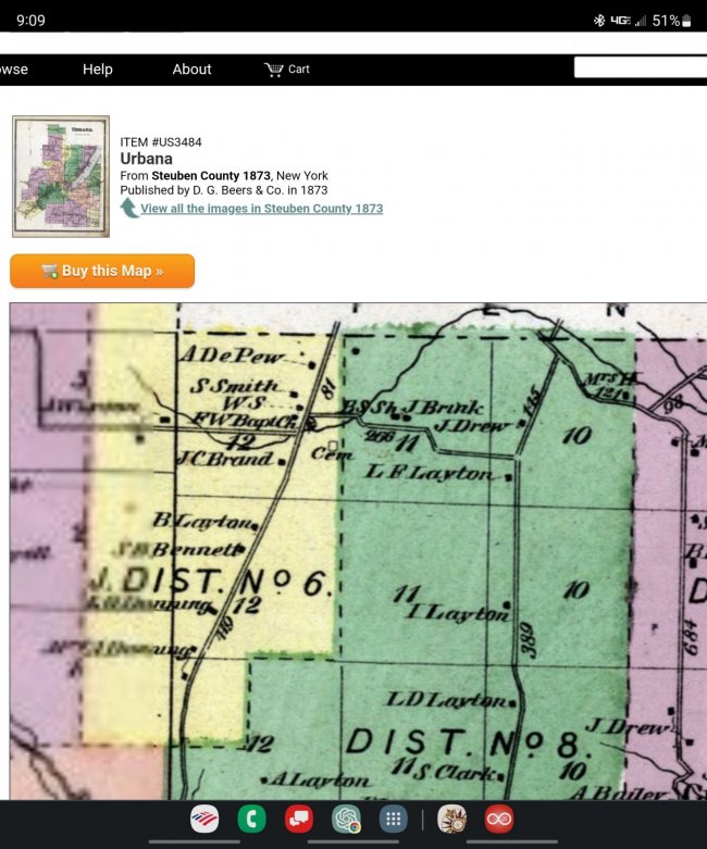
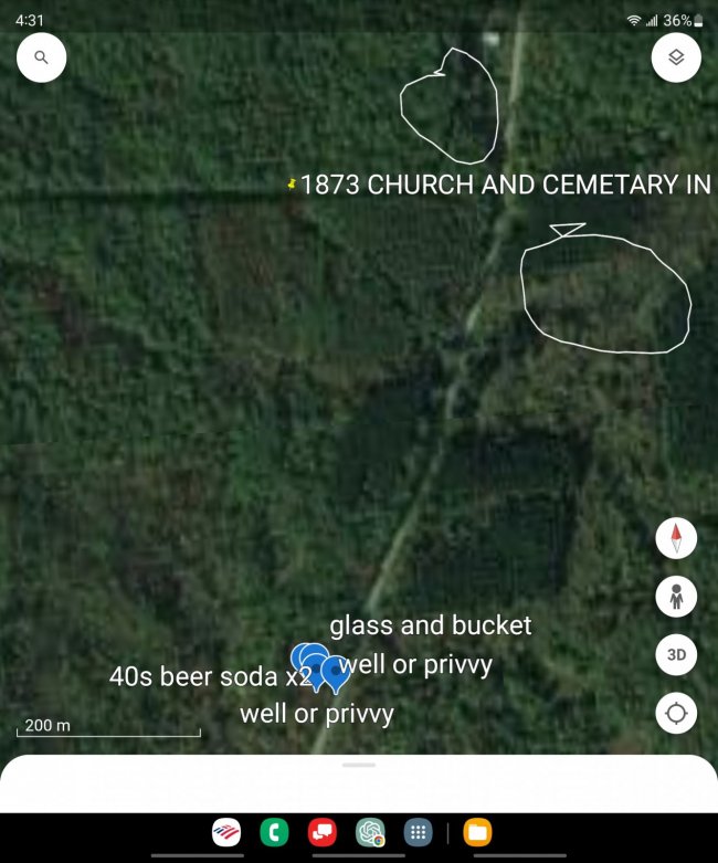
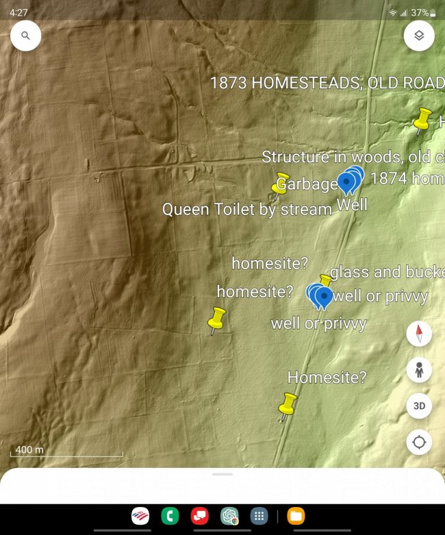
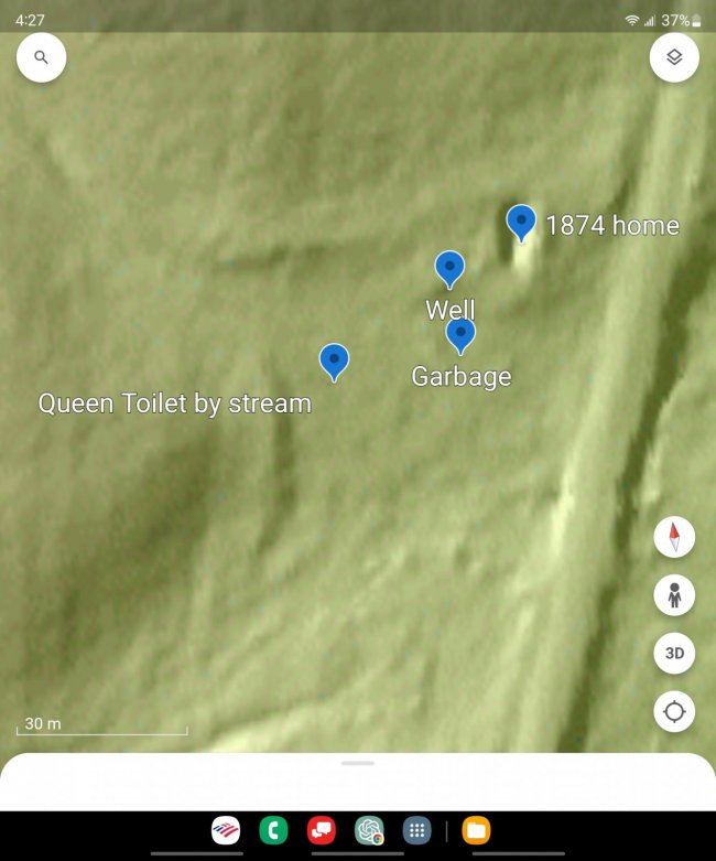
As a novice bottle hunter I have been receiving great support from the community and I still have many questions....but I want to contribute too. Recently I learned how to add a LiDAR layer to Google Earth that has literally helped me to discover dozens of places to explore, so I wanted to pass it along. I learned how to do it from a YouTuber called Walking Cam. She explains it better than I can, but I can share with you how I use it. Prior to discovering LiDAR I would goto the Library of Congress website to download high resolution maps from the 1800s. I'd identify old roads with existing roads to approximate where to look. This technique works pretty good but requires lots of guess work and hiking. With a LiDAR overlay I can make the foliage disappear and instantly see homesite foundations, cellar holes and old roads. The attached pictures are an example. The historic map shows locations of dwellings from the late 1800s but their locations are not very accurate, note the church seems to be North of the road. Google Earth doesn't show much, even captures during the fall do not show any details, so I hiked and hiked finding nothing. The LiDAR overlay clearly shows a huge structure on the other side of the road along with the homesites by their rectangular foundations. When imported into Google Earth on my phone I can literally walk directly to a spot of interest. Once there I can add pins of exact locations of features like a well, to help study the layout, help guide future searches and to find spots again. Its been a true game changer for me and I hope it helps others too. The LiDAR data is free, the software that integrates it into Google Earth is free and Google Earth is free. I tessted it this weekend, targeting 2 homesites, found both immediately, including some surface glass dumps (1930s on surface) and wells on each property. You can use the Google Earth app to measure structures or distances between pin drops. Good Luck!