Vernors Ginger Ale 150th B-Day

Welcome to our Antique Bottle community

Be a part of something great, join today!

SODAPOPBOB

Well-Known Member
Joined
Mar 10, 2010
Messages
11,502
Reaction score
49
Points
0
Here's a brief history about Woodward Avenue ...

http://www.motorcities.org/Story/Woodward+Avenue++the+Spine+of+Detroit-168.html

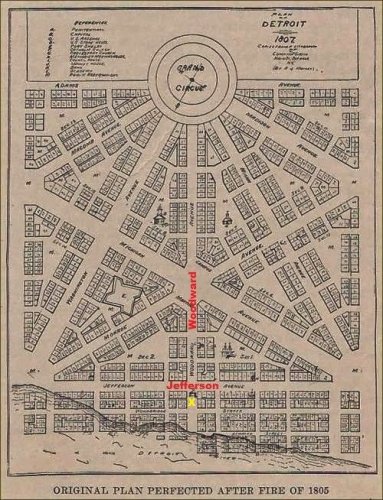
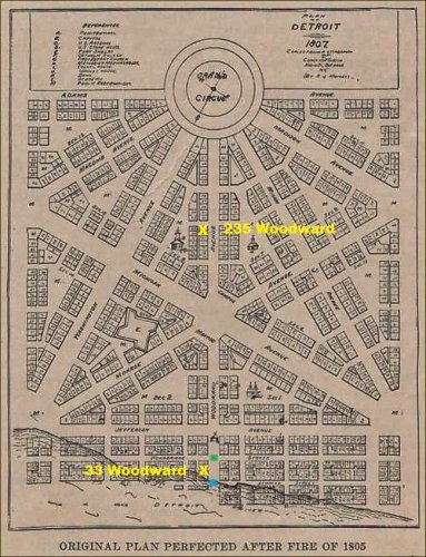
And here's a 1807 map of downtown Detroit

It doesn't show Clifford Street, but it does show Woodward Ave in the center going somewhat north and south and Jefferson Avenue near the bottom going somewhat east and west. This was long before any changes were made along the waterfront.
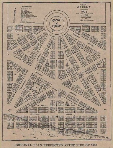
Vernors Detroit Map 1807.jpg
 

SODAPOPBOB

Well-Known Member
Joined
Mar 10, 2010
Messages
11,502
Reaction score
49
Points
0
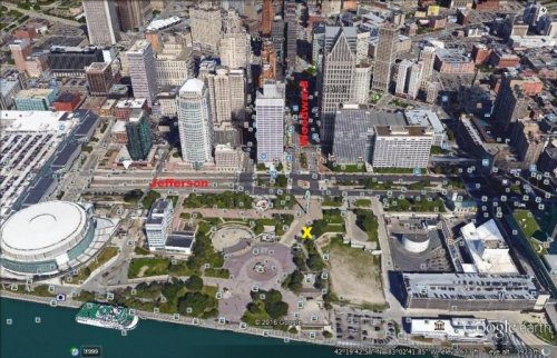
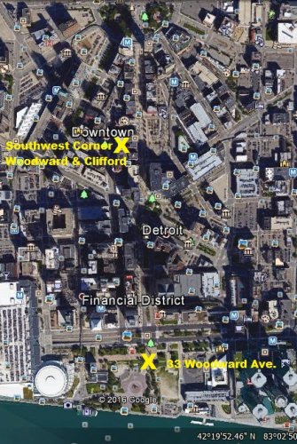
If 33 Wooward Avenue was "south of Jefferson" then Vernor's 1896-1940 drug store should have been located somewhere in the vicinity of the yellow X

Vernors Detroit Map 1807 (2).jpg
 

SODAPOPBOB

Well-Known Member
Joined
Mar 10, 2010
Messages
11,502
Reaction score
49
Points
0
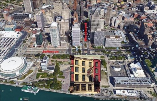
Here's what that area of downtown Detroit looks like today ...

Vernors Downtown Detroit 2016.jpg
 

SODAPOPBOB

Well-Known Member
Joined
Mar 10, 2010
Messages
11,502
Reaction score
49
Points
0
Leon

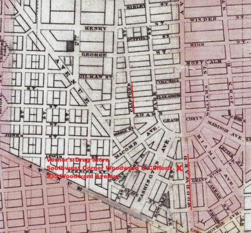
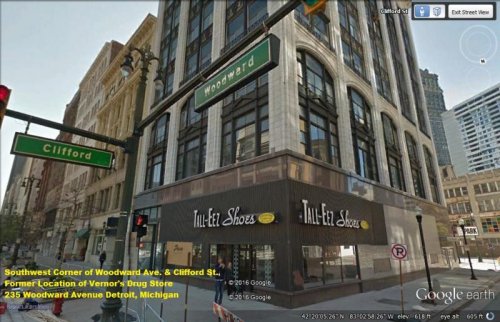
I got the location right this time for ...

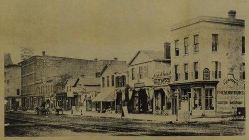
Vernor's Drug Store
Southwest Corner of Woodward Avenue & Clifford Street
235 Woodward Avenue
Detroit, Michigan


Vernor's Drug Store circa 1870s (2).jpg

1873 Map of Detroit

Vernors 1873 Detroit Map (2).jpg

2016 Google Earth Aerial

Vernors Corner of Woodward and Clifford.jpg

2016 Google Earth Street View

Vernors Southwest Corner of Woodward and Clifford.jpg
 

hemihampton

Well-Known Member
Joined
Oct 6, 2006
Messages
9,164
Reaction score
6,209
Points
113
Are you sure that's the same corner, was it at woodward & Jefferson? I thought it was a block closer to the river & that road now gone? LEON.


I'm quoting myself, Like I said, 1 block closer to the river & that road now gone. LEON.
 

SODAPOPBOB

Well-Known Member
Joined
Mar 10, 2010
Messages
11,502
Reaction score
49
Points
0
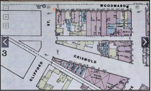
Four+ hours of studying dozens of Detroit maps finally paid off with ...

1884 Detroit Map

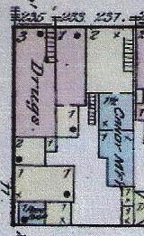
Drugs ~ Corner of Woodward St. and Clifford St. ~ Notice the number 235 on the Woodward side of the building ...

Vernor Map 1884 235 Woodward and Clifford (2).jpg

Vernor Map 1884 235 Woodward and Clifford (3).jpg

1897 Detroit Map

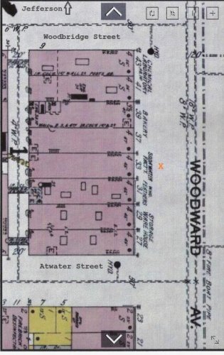
SODA WATER FACT'Y - Notice the number 33 on the Woodward side of the building ~ Located between Woodbridge and At-water. Woodbridge St. is one block south of Jefferson Ave. ...

Vernor Map 1897 33 Woodward between Woodbridge and Atwater (2).jpg

Vernor Map 1897 33 Woodward between Woodbridge and Atwater (3).jpg

1807 Detroit Map for birds-eye view. The colored squares at the bottom indicate ...

Green = Woodbridge Street
Blue = At-water Street

Vernors Detroit Map 1807 (4).jpg

Note: For some reason it won't allow me to use the word "At-water" so I had to hyphenize it.
 
Last edited:

SODAPOPBOB

Well-Known Member
Joined
Mar 10, 2010
Messages
11,502
Reaction score
49
Points
0
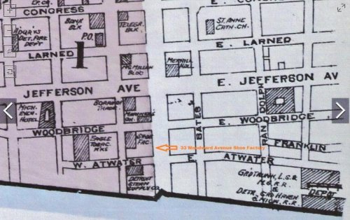
I was curious what type of business was at 33 Woodward Avenue before James Vernor moved there around 1896, and discovered that in 1884 the building was a Shoe Factory. Of course I don't know how long the Shoe Factory was in business, nor if other types of businesses occupied the building between 1884 and 1896, but I think its interesting to note it was a Shoe Factory at least 12 years before Vernor moved there. Vernor was located at the 33 Woodward address for about 44 years between 1896 and 1940 when he relocated again to the well known downtown multistory building.

1884 Detroit Map

Vernor Map 1884 33 Woodward Avenue Shoe Factory (2).jpg
 

SODAPOPBOB

Well-Known Member
Joined
Mar 10, 2010
Messages
11,502
Reaction score
49
Points
0
P.S.

However ...

Its possible that only the shaded area //// on the 1884 map was the Shoe Factory and that the Woodward side of the property was a vacant lot - I'm really not sure!
 

SODAPOPBOB

Well-Known Member
Joined
Mar 10, 2010
Messages
11,502
Reaction score
49
Points
0
Standby ...

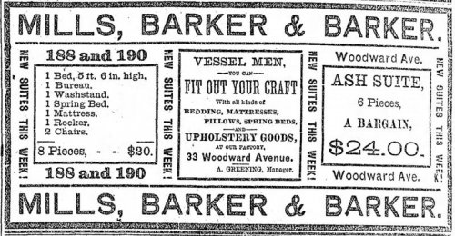
I just figured out that the shaded areas on the "Sanborn Fire Insurance Maps," like the ones I have been posting, indicate the businesses that Sandborn insured. So any building that was not insured by Sandborn would not be shown on their maps. In other words, there were definitely other businesses in that particular block, some prior to 1884, and some after 1884, which I will be posting newspaper ads for just as soon as I get them together. For starters, here's one from ...

April 14, 1884

Vernor 33 Woodward Ave April 14, 1884.jpg

Note: I title everything with "Vernor" whether it applies directly to James Vernor or not - that way all of my saved stuff is alphabetized in the same file.
 

Members online

Latest threads

Forum statistics

Threads
83,386
Messages
744,019
Members
24,415
Latest member
.TheNYBittersCollector.
Top