One last item to chew on. What will bring the storm north more then east is what as known as a negative NAO ( North Atlantic Oscillation ) Simply put storms in the late fall and early winter in the United States tend to come up the coast in a classic Nor'easter type of configuration when we have a negative NAO. We are just now today as of this past afternoon entered into a VERY negative NAO. Remember this pattern as this is what will bring below normal temperatures to much of the Mid Atlantic and New England this winter plus well above snowfall in the I-95 corridor from Charlotte to Boston. Here is a good web site which explains the NAO quite nicely. http://www.nc-climate.ncsu.edu/climate/patterns/NAO.html
Last years was bad also Rick I forgot about that one!! But it didn't have quite the impact as the 1991 storm, but funny you mentioned that storm as it was the only real snowfall here in the Delaware valley all winter.
That would depend on where you lived, I had no water at all by me in 91', but last year I had three feet of water in my basement Steve, first time ever...[][][][][]
My Dad was running my son to a Hockey tournament for me last year over in Pennsylvania and I remember the storm changing to heavy wet snow at night Jim and Rick.
This storm coming now will be a very complex interaction between two storms the Hurricane and a low pressure system coming across the upper mid-west heading to the east coast. Its is this storm which will have plenty of cold air associated with it when it arrives at the east coast will Capture and then merge with the hurricane/tropical storm Sandy and do unreal damage to the entire mid Atlantic and New England. The following states and areas will see Tropical storm/hurricane force winds and heavy rain.
Eastern North Carolina
Eastern Virginia
Delaware
New Jersey
Long Island
Rhode Island
Massachusetts
New Hampshire
Eastern Maine
The following states will see rain change to heavy wet snow as cold air gets wrapped into the storm.
Virginia Mountains above 1000 feet
West Virginia Mountains above 1000 feet
Western Maryland Mountains above 1000 feet
South Western Central Pennsylvania above 1000 feet
West Central Pennsylvania near State college above 1000 feet
North, West Central Pennsylvania above 1000 feet
South Western New York State above 500 feet
Central New York above 500 feet
Snow totals can exceed 2 feet in the higher peaks and 4 to 8 inches will be the more common amounts seen in these areas.
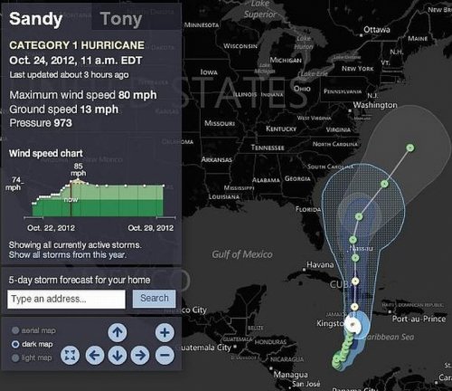
Potential for catastrophic flooding because of the high tides which will coincide in some areas near Long Island,New york City, North eastern New Jersey,Rhode Island. Beach erosion from Maryland to Maine can be expected. With each and every run I have done on my computer model the probability of the path I showed you yesterday has increased from the likelihood at the onset which was a 40 percent chance to today where it is at 70 percent chance now in 24 hours. I will give you more updates at dinner time off to work for now.
These are the words from a world class meteorologist very skilled at hurricane prediction from this morning in a tweet. Joe Bastardi â€@BigJoeBastardi
Again RARELY IS THERE THIS MUCH POTENTIAL ON A WEATHER MAP! That should be the first reason.. the pattern, to be very concerned!!
Jim here is the latest, and it is still trending west. Most of the worlds weather outlets I look to for comparison to my own software are all in agreement now that the storm will at a minimum impact the US somewhere between Cape Hatteras and Boston.This latest forecast picture Link
https://twitter.com/BigJoeBastardi/status/261175093261127680/photo/1/large I am showing you would bring the storm right up the Delaware bay. If this happens New York and your area will be severely impacted as you will be on the right flank of the eye wall.It would be no picnic in my area either as we would be in the center of the eye wall. Notice the storms strength is at 935 a monster!!!

 ][
][