Steve/sewell
Well-Known Member
- Joined
- Jan 23, 2010
- Messages
- 6,108
- Reaction score
- 5
- Points
- 0
Yeah Chuck I hope I am wrong as this could have an enormous impact on our lives.The definition of a Category 3 hurricane is as follows.
Winds around the eye wall at 115 to 130 mph.
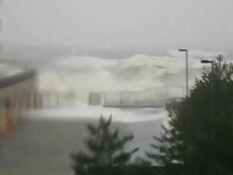
Sustained winds 50 to 75 mph around a broad area. A central pressure of 945–964 mbar 7.91–28.47 Barometric Pressure would normally be seen in a category 3 hurricane but in the case of Sandy even though she is now predicted at Category 3 strength her lowest pressure may be at Category 5 strength in a very small area near the inner eye wall bands. A storm surge of 5 to 10 feet that would put Manhattan under 3 feet of water in a few minutes would seem surreal to those caught off guard.This would bring New York City to a standstill as power would be lost for weeks if that occurred.
Devastating damage IS going to occur.Tropical cyclones of Category 3 and higher are described as major hurricanes in the Atlantic or Eastern Pacific basins. These storms can cause structural damage to small residences and utility buildings, particularly those of wood frame or manufactured materials with minor curtainwall failures. Buildings that lack a solid foundation, such as mobile homes, are usually destroyed, and gable-end roofs are peeled off. Manufactured homes usually sustain severe and irreparable damage. Flooding near the coast destroys smaller structures, while larger structures are struck by floating debris. A large number of trees are uprooted or snapped, isolating many areas. Additionally, terrain may be flooded well inland. Near-total to total power loss is likely for up to several weeks and water will likely also be lost. Mix in a powerful Nor'easter to its left flank and you have the recipe for disaster.Boy if we ever needed a push of cold air from Canada now would be the time. As a weather connoisseur part of me is excited by this, but as you age in life you realize just how destructive an event like this can be. Personally I am frightened by the prospects at the loss of life and property that will unfold in just a couple of days. God help the good people of the North East and the Mid Atlantic because his power will be needed soon enough to get us through this. Please stay safe everyone and move those wonderful bottles and glass you like to show off in your windows to a safe place in your homes for a week. You will be glad you did.
Winds around the eye wall at 115 to 130 mph.
Sustained winds 50 to 75 mph around a broad area. A central pressure of 945–964 mbar 7.91–28.47 Barometric Pressure would normally be seen in a category 3 hurricane but in the case of Sandy even though she is now predicted at Category 3 strength her lowest pressure may be at Category 5 strength in a very small area near the inner eye wall bands. A storm surge of 5 to 10 feet that would put Manhattan under 3 feet of water in a few minutes would seem surreal to those caught off guard.This would bring New York City to a standstill as power would be lost for weeks if that occurred.
Devastating damage IS going to occur.Tropical cyclones of Category 3 and higher are described as major hurricanes in the Atlantic or Eastern Pacific basins. These storms can cause structural damage to small residences and utility buildings, particularly those of wood frame or manufactured materials with minor curtainwall failures. Buildings that lack a solid foundation, such as mobile homes, are usually destroyed, and gable-end roofs are peeled off. Manufactured homes usually sustain severe and irreparable damage. Flooding near the coast destroys smaller structures, while larger structures are struck by floating debris. A large number of trees are uprooted or snapped, isolating many areas. Additionally, terrain may be flooded well inland. Near-total to total power loss is likely for up to several weeks and water will likely also be lost. Mix in a powerful Nor'easter to its left flank and you have the recipe for disaster.Boy if we ever needed a push of cold air from Canada now would be the time. As a weather connoisseur part of me is excited by this, but as you age in life you realize just how destructive an event like this can be. Personally I am frightened by the prospects at the loss of life and property that will unfold in just a couple of days. God help the good people of the North East and the Mid Atlantic because his power will be needed soon enough to get us through this. Please stay safe everyone and move those wonderful bottles and glass you like to show off in your windows to a safe place in your homes for a week. You will be glad you did.


") ]
]